August Tropical Wrapup
 Well after expecting a very active hurricane season, so far we have been treated to very few storms. So few, in fact, that the weather forecasters have reduced the predicted number of storms twice.
Experts Lower Hurricane Forecast to 5
This is certainly no time to relax and count our bessings. We are now in the midst of the busiest time of the year for tropical activity so more storms are likely to form. And, of course, it only takes one direct hit on whatever location you are at to be a bad season.
However, NOAA Continues to Predict Above Normal Hurricane Season. We are still in the early years of the Atlantic Multidecadal Cycle when a higher than average number of storms is expected, so even if the actual number of is reduced once again, it is still a good bet that September and October will be busy months.
With thanks to: NOAA Released August 8, 2006
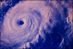
 We ended August with 3 active system - Ernesto, John and Kristy - but only Ernesto affected the Atlantic. Ernesto was the first storm this year to become a hurricane and fortuanely it was only a Catagory 1 storm before it broke down and remained a tropical storm. Twice the prediction was for the storm to re-strengthen to a hurricane but its forward movement resulted in interaction with land before sufficient strength could be achieved.
In the Pacific, John came to our attention as a Catagory 4 monster and steadily dwindled in strength. Heavy waves, wind and rain battered the western Mexican coast quite a bit but the real concern was that it would cross Baja California at full strength. Fortunatley by the time the storm reached Baja it was only a Cat 1 and quickly weakened to a tropical storm. Now the storm center is crossing along the length of the peninsula which would have certainly been a disaster if the storm strength was anywhere near its original level.
John and tropical storm Kristy are headed for cooler waters so we shouldn't hear much more about either storm.
Trackbacked to: Dumb Ox News, Woman Honor Thyself, 123Beta


<< Home