Gulf Coast Hurricane Tracker

A single source reference on tropical weather predictions. With a traditional focus on the upper Texas and Louisiana Gulf Coast we've maintained links to track all Atlantic Basin, Caribbean and eastern Pacific storm systems. We are now expanding our view to tropical storms throughout the world intending to be a comprehensive global storm tracking resource.

Thursday, May 31, 2007

Cities at risk

Tomorrow officially begins the 2007 hurricane season. It promises to be an exciting season. Almost as if on queue, an area of disturbed weather is forming in the western Caribbean near the Yucatan peninsula. Development is possible during the next 24 hours.

There has been much discussion on the MSM about the dangers of living along the coast and how more and more people live on the coast. The "experts" all deride this decision and love affair of ours in living near the water because of the dangers involved and the costs both in material and lives when a hurricane hits.

The Associated Press has pinpointed five of the most vulnerable U.S. coastal spots.

Among them: Galveston, Texas, sitting uneasily by the Gulf of Mexico, its residents limited to a single evacuation route; Miami, full of elderly people and others who might be trapped; and New York City, long spared a major storm but susceptible to a calamity of submerged subways and refugees caught in horrendous traffic jams.

Like so many other places, they are vulnerable because of geography. But mostly, they are imperiled because Americans have a love affair with the coast.

...

"If we really want to stop hurricane losses, we really have to slow down the kind of growth that's happening along the coast," says Jay Baker, a geography professor at Florida State University, "rather than worrying about how many hurricanes are going to come."
So to where should we go:
  • Sunny California is a great place to be. I love it there - Oh wait, earthquakes, forest fires and mudslides.
  • The midwest is away from the water - Oh... tornadoes, hail and severe thunderstorms

  • The north west and Canada -- deep snow and temps as low as -45F (or -45 C, at that temperature is really doesn't matter which scale you use).

  • The east coast is being warned about the increased threat of a potential hurricane.

  • The Ohio valley and Appalachia get inundated with the heavy rain when storms come ashore along the Gulf coast and head north.
It seems like there is no safe place on the entire continent. I'm sure there are similar conditions all around the planet. The fact is that there is no place that is totally safe. We migrate to those areas that we like. Some people like the farms, some like the cities, and some like the coasts.

The point is to adapt and to be prepared. A little common sense and awareness can go a long way this summer.

Linkfest Haven, the Blogger's Oasis

Trackposted to Perri Nelson's Website, The Virtuous Republic, A Blog For All, DeMediacratic Nation, Leaning Straight Up, The Amboy Times, Colloquium, Conservative Cat, Pursuing Holiness, Pet's Garden Blog, Diary of the Mad Pigeon, Wake Up America, stikNstein... has no mercy, Pirate's Cove, The Pink Flamingo, High Desert Wanderer, and Right Voices, thanks to Linkfest Haven Deluxe.

Tuesday, May 29, 2007

Tropical Deression TWO-E could become Hurricane Barbara

Update II: Barbara has weakened into tropical depression Barbara. Currently moving due east at 2 knots Barbara is expected to strengthen as the storm track again moves north towards land. If no further build-up occurs then the storm will pose no real threat and will become just a local rainmaker.

UPDATE: Tropical Storm Barbara is now here - and may become the first hurricane of 2007 by the weekend. The really interesting aspect of this development is how the predicted storm track has moved. At the bottom of this post I have the original predicted storm track posted at the bottom of this post. At that time the storm was expected to move parallel to the Mexican coast.

As of this evening (5/30/07), the 5-day cone of probability is showing the track of the storm moving towards due north. If the storm track continues to move in a more northerly direction then there is a good chance that Hurricane Barbara will end up in the Bay of Campeche.

We will be watching this puppy because as those of us who live on the Gulf Coast know, once a storm enters the Gulf it can go anywhere. Barbara could be a weather maker for us here in Texas yet.
------------------------------------

Tropical depression TWO-E has formed in the eastern Pacific. The National Hurricane Center is currently predicting this storm will eventually grow to hurricane strength. Rain from this storm will likely affect the southwestern coast of Mexico if the track follows the prediction as shown on the graphic to the right. Note that as of Tuesday evening the graph shows the storm moving south and strengthening to tropical storm status and then making a U-turn and heading north as it increases in strength to a low scale hurricane. This is a live graphic so the image will be updated regularly.

I have been watching the storm development in the eastern Pacific this year for two primary reasons - 1) because of the low activity last year allowed me to appreciate the storms that form in the eastern Pacific and 2) because I have noticed that these storms frequently do cross the isthmus of Central America or even Mexico and affect the US from the desert southwest to as far east as Louisiana.

The media have essentially ignored this possibility in past. Several instances of storms that pumped heavy moisture into the southwest US or actually made landfall along the Texas coast that were discounted until suddenly it was upon us.

TD TWO-E is very close to the coast and with the slight movement predicted the potential exists for the steering currents to shift bringing the rain towards us. By Wednesday or Thursday this will be Tropical Storm Barbara. A slight turn to the north or north-west could bring hurricane Barbara ashore. Even if the storm doesn't make landfall, the stronger NE quadrant will be affecting the coast with the potential for some damage and threats to human life.

Meanwhile Topical Depression Alvin continues to move slowly west over open water.

Linkfest Haven, the Blogger's Oasis

Trackposted to Right Pundits, Perri Nelson's Website, Blog @ MoreWhat.com, The Random Yak, Azamatterofact, DeMediacratic Nation, guerrilla radio, Adam's Blog, Big Dog's Weblog, Maggie's Notebook, Webloggin, Leaning Straight Up, Cao's Blog, The Bullwinkle Blog, The Amboy Times, The Florida Masochist, Conservative Cat, Pursuing Holiness, Blue Collar Muse, third world county, stikNstein... has no mercy, The Crazy Rants of Samantha Burns, Blue Star Chronicles, Pirate's Cove, Nuke's news and views, The Pink Flamingo, Planck's Constant, Dumb Ox Daily News, Right Voices, Gone Hollywood, and The Yankee Sailor, thanks to Linkfest Haven Deluxe.

Sunday, May 27, 2007

Re-awaken lonely old posts

I was tagged by Dumb Ox for the "Re-Awaken Lonely Old Posts" blog tag so I am re-posting this post from last July because with all of the debate and accusations regarding Global Warming, this is a real solution that addresses a real problem and IF the alarmists are correct (which I do not think they are) it provides a GW solution that has practical implications AND an economic driver rather than simply imposing a tax burden. This solution from "Engineer Live" provides a solution to many issues not simply to a belief system that will likely prove false someday.

----------------------------------------------------------------------------------------

Now this is a proposal that makes sense

Regardless of the debate as to the true cause of global warming - man made or natural, real solutions will only come to fruition if there is an economic driver and benefit involved.

This article discussed a real proposal in which CO2 is sequestered in a permanent repository and then used as needed in an existing application. This takes CO2 out of the atmosphere ( which I really do not think will matter in any way) and makes it available for use where CO2 is currently being used anyway. Any opportunity to use an existing available supply to improve a process or reduce cost is a good opportunity and it is projects like this that should be supported. The fact is that this has an economic driver and addresses a real issue - improving the oil drilling efficiency. If some people believe that removing the CO2 from the atmosphere will make a difference in global warming, that is fine. What a proposal lie this does not do is impose an impractical solution on a non-controllable issue but rather addresses a real time problem and provides some additional benefits. (From Engineer Live! a process engineering e-magazine from Europe)


Shell and Statoil join forces in carbon sequestration
project

Shell and Statoil have announced a joint project to store up to 2.5m tonnes of carbon dioxide underground every year for use in enhanced oil recovery. At the same time, a new report from the International Energy Agency looks at what is needed over the next 30–50 years to make carbon sequestration a worldwide reality.

Shell and Statoil have signed an agreement to work towards developing the world’s largest project using carbon dioxide (CO2) for enhanced oil recovery (EOR) offshore. The concept involves capturing CO2 from power generation and utilising it to enhance oil recovery, resulting in increased energy production with lower CO2 impact.

The project, which could eventually cost up to 1.2b Euro, consists of a gas-fired power plant and
methanol production facility at Tjeldbergodden in mid-Norway, providing CO2 to the Draugen and Heidrun offshore oil and gas fields. Power from the plant will also be provided to the offshore fields, enabling near zero CO2 and nitrogen oxide emissions from these installations. The various elements of the project will be phased in between 2010 and 2012.

Establishing this CO2 value chain is technologically and commercially challenging and according to the companies will depend on substantial government funding and involvement. The project will also rely on the involvement of industrial stakeholders and electricity users in the region.


The project is in line with international and national climate aspirations and responds to the important challenges of increasing energy supplies and addressing the related CO2 emissions and will contribute to long-term power balance in mid-Norway. At the same time it secures stable power delivery to industry producing vital hydrocarbons for Europe. The project could
potentially store approximately 2–2.5m tonnes of CO2 annually in two different fields.

“This is an important milestone for Shell towards our vision for greener fossil fuels with part of the CO2 captured and sequestrated underground,” noted ceo Jeroen van der Veer.
“Our aim is to establish a broad partnership in order to realise this ground-breaking project. This CO2 project responds to vital future challenges facing society, the environment and the industry,” said Statoil ceo Helge Lund.
Since 2004, his company has played a key role on the technical committee of a 17-nation group working to compile a list of technology projects which can help to reduce CO2 emissions.


The Carbon Sequestration Leadership Forum (CSLF) maintains that improving energy efficiency and using renewable energy are not enough to fulfil the Kyoto protocol. Capturing and storing CO2 could be required in addition, according to the group – which includes Norway among its members. The other participants are the USA, Canada, Brazil, Mexico, Colombia, South Africa, India, China, Japan, Australia, Russia, Germany, France, Italy, the UK and the European
Commission. In addition to coordinating member efforts to develop carbon sequestration technology, the CSLF is seeking to harmonise national regulations on this issue.


A 30-50 year plan
Meanwhile, the International Energy Agency (IEA) has published a 252-page study entitled Prospects for CO2 capture and storage. The study sheds light on the economic potential for CO2 capture and storage (CCS) over the next 30–50 years using the energy technology perspectives (ETP) model, a quantitative optimisation model developed by the IEA. It assesses the prospects for CCS technologies based on the energy resources, regional and sectoral shifts in global energy demands and modification in energy technology portfolios. It compares CCS with other emission mitigation options and identifies key issues and uncertainties that should be considered in relation to CCS and its use as a CO2 emission mitigation tool.

In terms of the challenges ahead and priorities for action, the study focuses on nine points.

Firstly, a five-fold increase in funding for research, design and development (RD&D) on CCS will be needed to prepare the necessary technologies for full-scale commercial introduction within 10–15 years.

Secondly, in terms of capture technologies, the IEA says that RD&D efforts should focus on innovative capture technologies with high efficiencies and low cost. Special attention should be given to the integration of CCS into new power plant designs. At least several more projects are needed to demonstrate CO2 capture on a commercial scale. Finding sufficient funds for
such projects will, says the IEA, be a significant challenge and some investors might wish to proceed immediately to commercialisation.

The study’s third point is that a new generation of highly efficient coal-fired power plants is
being developed and introduced, but that it will take them decades to conquer the market. This means that only synchronous development of a new generation of plants and CCS technologies will lead to CCS market introduction within 10–15 years. This also means that work should continue on all capture options such as CCS with steam cycles, including oxy-fuelling, and CCS for gasification cycles.

The fourth point concerns storage. Sufficient proof of storage permanence is essential for any credible CCS strategy and for public awareness and acceptance. As a first step, RD&D should focus on CO2 projects that enhance fossil fuel production and on those which advance knowledge on sub-sea underground storage, and aquifer storage in locations with low population density. Stakeholder processes for reviewing, commenting and addressing concerns should be built into all pilot projects. Procedures for independently verifying and monitoring storage and related activities should also be established.

Fifthly, to facilitate the acceptance of CCS by the general public, industry decision makers, and policy makers, it will be necessary to make available and broadly disseminate the results of RD&D projects.

The IEA’s sixth point is that given the controversial nature of oceanic storage, CO2 storage efforts should primarily focus on underground options, both offshore and onshore.

The next point is that further investment in CCS, including demonstration projects, is hindered in some countries by uncertainties over the lack of appropriate legal and regulatory frameworks. Countries should create an enabling legal and regulatory environment for national CO2 storage projects. In the interests of time, and given the diversity of institutional set-ups and regulations between countries, working at the national level using existing frameworks may be the best short-term option.

Penultimately, the IEA says that contracting parties to international instruments should be proactive in clarifying the legal status of CO2 storage in the marine environment, taking into consideration their objectives to stabilise CO2 in the atmosphere.

Finally, in addition to the acceleration of RD&D funding, countries should create a level playing field for CCS alongside other climate change mitigation technologies. This includes ensuring that various climate change mitigation instruments, including market-oriented trading schemes, are
adapted to include CCS.


It will be interesting to see if the environmentalists can support this type of project when the results address something that they champion (reduction of CO2) AND simultaneaously something they oppose (improved productivity in oil drilling). I'm sure that this will never be reported in the MSM (except maybe in a business section).

Tropical Depression One-E


Pacific Tropical activity is always busier than that of the Atlantic. The good news is that this storm is tracking away from the western coast of Mexico. I expected it to come towards us since the Mariner's 1-2-3 graphic (previous post) kept showing the area of disturbance moving towards the east. Details can be seen in the Pacific Tropical Update in the sidebar. Further development is possible and this storm will become Tropical Storm Alvin.

Unless this storm threatens land, I won't be posting anymore here but the graphic is live so it should continuously update should conditions change.

Friday, May 25, 2007

Possible Eastern Pacific Disturbance?


Check the National Hurricane Center info in the sidebar for details.

Post your bets now...Odds are on a strong season

As we get close to the official start of the hurricane season for 2007, weather experts are shoring up their predictions on the number of storms and intensity.

The short of it is " hang on to your hats, folks. It looks like it's going to be a rough ride."

The National Oceanic and Atmospheric Administration's report calls for 13 to 17 named storms, up to 10 of which might become hurricanes. About 10 tropical storms and hurricanes form during an average year.

Federal officials, including Secretary of Homeland Security Michael Chertoff, took the opportunity Tuesday to warn coastal-dwelling Americans not to become complacent about the coming season, after a relatively mild hurricane season last year.

"It is a big mistake to count on being lucky again," Chertoff said. "You are much better off preparing yourself for the worst, and if nothing happens, it's a bonus."

Becoming complacent is the worst thing that we as residents along the coasts can become. We MUST be prepared for one or more storms to hit in our area. If we do not come then we are ahead of the game. It is better to be prepared and not need to be then have a major situation and not know what to do.

According to U.S. Census figures released Tuesday, 12 percent of the U.S. population, or 34.9 million people, live in the coastal areas — from North Carolina to Texas — most threatened by hurricanes. That's up from 10 million in 1950.

This means there are a lot of new coastal residents who may not have experienced a hurricane before, especially along the upper Texas coast, which hasn't been hit by a major hurricane since 1983, when Alicia struck.

I do not mean in any way that we should be all panicky and worried about the sky falling. Being prepared means:

  • Having at least 1/2 of a tank of gas in the car at all times.
  • Knowing the preferred evacuation route from your area.
  • Knowing where you want to go if it is different from the recommended route.
  • Knowing how early you would need to leave to get to you preferred destination - are you going someplace in particular or is any hotel or shelter sufficient.
  • What are you going to with the pets?
  • Wood to board up windows or other methods to secure the house.
  • If you are not supposed to leave then making sure you have the proper supplies - fresh water, canned foods, etc.
Another way to be prepared is that when a storm approaches, make sure all loose objects are brought indoors or otherwise secured. Anything loose will become a projectile and create much damage, destruction and death. A clean yard can help to keep the damage down. Pruning back any trees and bushes will also minimize damage to windows and the outside of the house.

The season officially starts Friday June 1 bit we've already had our first named storm - subtropical storm Andrea. With El Nino out of the picture and the temperature swing in the Pacific over to a La Nina combined with warm sea surface temperatures the conditions are right for a strong season. We must be prepared.

Sci Guy (Houston Chronicle Science Blog):

The final hurricane season forecast is in: highly active


Linkfest Haven, the Blogger's Oasis

Trackposted to Outside the Beltway, The Virtuous Republic, Perri Nelson's Website, Right Truth, Shadowscope, The Amboy Times, Leaning Straight Up, Pursuing Holiness, Here's looking at . . . me!, The HILL Chronicles, Right Celebrity, third world county, Woman Honor Thyself, stikNstein... has no mercy, , Nuke's news and views, Pirate's Cove, The Right Nation, The Pink Flamingo, Dumb Ox Daily News, Blog @ MoreWhat.com, The Random Yak, A Blog For All, DeMediacratic Nation, Maggie's Notebook, Adam's Blog, Webloggin, Cao's Blog, Phastidio.net, The Bullwinkle Blog, Colloquium, , Conservative Cat, Blue Collar Muse, Diary of the Mad Pigeon, The Crazy Rants of Samantha Burns, The World According to Carl, Blue Star Chronicles, The Yankee Sailor, and Gone Hollywood, thanks to Linkfest Haven Deluxe.

Monday, May 21, 2007

Dance on his Grave

Sidra Smart, disillusioned ex-wife of a fundamentalist preacher, never imagined herself running a PI business, that is until she inherits her late brother's detective agency.

Soon, a woman stumbles in with vague flashbacks of a 30-year-old murder. Intrigued by the story, Sid takes the case and soon plunges into a surreal world where the flames of Creole superstition and passion burn as hot as the memories of child abuse, arson, and murder.


So begins a very exciting book that takes place in good - ole Orange, Tx. As some of you know, Orange was my home for 14 years. I moved down to Texas from the hustle and bustle of north central New Jersey in 1988 and settled in the small town swamp that really became home for many years. While there I met many good friends and became part of a family with an exciting history in its own right.

Saturday was the first time I've been back to the Orange area since I moved to Houston in 2002. I got to catch up with the in-laws and the out-laws. The occasion was the launching of this novel set in Orange, the first of a series by non other than my loving Mother-in-law.


This is an interview with the author from February. Dance on His Grave is now available at any online or brick & mortar bookstore. If you can't find it on the shelf, your bookseller will be happy to order it for you. It is also available on Mobipocket.

Sylvia is also a fellow blogger and can be read at her blog and also her website.

So in a shameless case of unabashed commercialism I take this break from weather and tropical systems to mention this other part of the Gulf Coast that I gained- FAMILY - and to say

BUY THIS BOOK!!!

Buy 2 copies. Buy it for your friends (adult friends - it's not for kids). And if your neighborhood bookstore doesn't have it in stock yet, ask them to order it a keep a few copies on the shelf.

Linkfest Haven, the Blogger's Oasis

Trackposted to Outside the Beltway, Is It Just Me?, The Virtuous Republic, Perri Nelson's Website, Mark My Words, Big Dog's Weblog, DragonLady's World, The Pet Haven Blog, The Amboy Times, Pursuing Holiness, Right Celebrity, third world county, Woman Honor Thyself, Wake Up America, Stageleft, , stikNstein... has no mercy, Nuke's news and views, Pirate's Cove, The Pink Flamingo, Dumb Ox Daily News, Right Voices, Blog @ MoreWhat.com, Committees of Correspondence, A Blog For All, The Random Yak, DeMediacratic Nation, Adam's Blog, Webloggin, Phastidio.net, The Bullwinkle Blog, Cao's Blog, , Colloquium, Jo's Cafe, Conservative Cat, Diary of the Mad Pigeon, The Crazy Rants of Samantha Burns, Walls of the City, The World According to Carl, Blue Star Chronicles, High Desert Wanderer, and The Yankee Sailor, thanks to Linkfest Haven Deluxe.

Tuesday, May 15, 2007

2007 Atlantic Hurricane Names

As the 2007 Hurricane season looms upon us, here are the names for tropical storms and hurricanes for the Atlantic Ocean, Caribbean Sea, and Gulf of Mexico. As we discussed last week, Andrea has already visited us starting the season a wee bit early.


Names are chosen in advance by a committee of the World Meteorological Organization, and are recycled every 6 years (except for unusually intense and damaging hurricanes, whose names are then retired).


Each storm name becomes an active link to Weather Street hurricane advisory page as each storm forms.

Pacific Tropical Storm Names

With last year's hurricane season being so light I turned toward the Pacific for some action. Actually I only focused on the Eastern Pacific when I noticed that a significant amount of weather was coming across Mexico into western and central Texas. As a matter of fact, our strongest storms last year were Pacific tropical weather that pumped moisture across the desert resulting in floods in Phoenix and El Paso. This is not to discount the many very strong storms in the western Pacific that caused much death and destruction in places like China, Vietnam and Indonesia. I just don't know much about those areas and therefore it is harder to comment.

Hopefully this year will be mild in all areas across the world but unfortunately that is not likely. So to get ready for the upcoming tropical season across both oceans, here is the list of storm names for Eastern Pacific Ocean courtesy of the National Hurricane Center.

Alvin, Barbara, Cosme, Delila, Erick, Flossie, Gil, Henriette, Ivo, Juliette, Kiko, Lorena, Manuel, Narda, Octave, Priscilla, Raymond, Sonia, Tico, Velma, Wallis, Xina, York, Zelda

Saturday, May 12, 2007

Some New Stuff

Hey Friends,

Just want to say hello and ask for some feedback on a few changes. First of all, I've dropped the large format AccuWeather dashboard. Instead I went back to the Weather channel magnet. just enter your ZIP code for the weather forecast in your area.

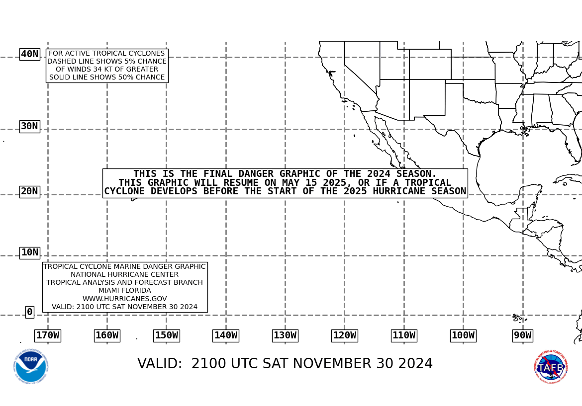
The most noticeable difference is the addition of the Mariner's 1-2-3 Rule graphic from the National Weather Service. This provides a rough estimate of where tropical systems are forming and how they are predicted to progress. As of this writing, NTD Andrea is on the chart churning near Florida.

Additionally, I've added continuously updated RSS feeds for the Atlantic Basin and Eastern Pacific. Now the National Hurricane Center official statements are here and completely up to date for use as an accurate reference.

If the 07 tropical season is as active as is currently being predicted, these tools should help us a bunch. I will also be adding links on evacuation plans from various regions along the coast and survival info.

Let me know what you think.

Wednesday, May 09, 2007

Tropical Storm Andrea heads off the season 3 weeks early


Tropical Storm Andrea has formed off the coast of Georgia and South Carolina with winds of 45 mph as of 11 am EDT today. Bryan at Stormtrack.com got the prediction right while the NWS was downplaying the possibility because the water temperatures and the winds weren't quite right.
Andrea has continued to churn this afternoon off the Southeast U.S. coast. The storm is nearly stationary, wobbling ever so much to the west. The bigger development this afternoon has been the complete dissolution of convection on the western flank of the storm (Figure 1). My best guess for the reason why the convection died so quickly is that the storm was ingesting very dry air that is in place along the East Coast and the dry air stabilized the mid-levels of the atmosphere.
This is very unusual. It may be the earliest that a tropical system has formed in the Atlantic and may be a sign of things to come - or it could be a fluke. The point is that we need to be prepared and plan properly how we are going to handle any bad storms that come our way.

Future posts will deal with evacuation plans and preparedness. For right now we just need to watch what happens in the Atlantic and keep an eye on the weather. Andrea won't amount to much and will likely peter out before she makes landfall as the graphics are showing. The National Hurricane Center isn't even using the traditional tropical storm symbol to mark this storm but is rather still designating it as a low pressure system.

Updated Statement from the National Hurricane Center


Linkfest Haven, the Blogger's Oasis

Trackposted to Outside the Beltway, The Virtuous Republic, Perri Nelson's Website, Blog @ MoreWhat.com, The Random Yak, Adam's Blog, Big Dog's Weblog, Stuck On Stupid, Cao's Blog, Leaning Straight Up, The Amboy Times, The Florida Masochist, Conservative Cat, Rightlinx, The Magical Rose Garden, Allie Is Wired, third world county, stikNstein... has no mercy, The Crazy Rants of Samantha Burns, The World According to Carl, Pirate's Cove, The Pink Flamingo, Planck's Constant, Dumb Ox Daily News, Wake Up America, Right Voices, Gone Hollywood, and The Yankee Sailor, thanks to Linkfest Haven Deluxe. And Woman Honor Thyself

Tuesday, May 08, 2007

Higher chance of Gulf Coast hurricane in '07

The forecasts for the 2007 tropical storm season have been for a higher than normal season. The main focus of this article seems to be the costs of these storms. The most immediate is the costs to the energy sector. Since gasoline and oil prices respond to the commodities markets, we are already seeing the prices increase in anticipation of the summer driving season and the anticipation of storms through the Gulf.

2006 was also predicted to be a higher than normal season yet as we saw that did not materialize. We must not let a mild tropical season fool us into thinking that we do not have anything to worry about. Complacency during hurricane season can be deadly. We need to be vigilant as storms develop and take the appropriate action should landfall become likely.

Not quite tropical but getting that way

A non-tropical system is forming off the South Carolina/ Georgia coast. This system has high winds, heavy rain and is circulating around a low pressure system. Winds are already above tropical storm strength.

The National Hurricane Center issued a Special Tropical Disturbance Statement at 4:00 this afternoon.


000
WONT41 KNHC 082003
DSAAT
SPECIAL TROPICAL DISTURBANCE STATEMENT
NWS TPC/NATIONAL HURRICANE CENTER MIAMI FL
400 PM EDT TUE MAY 8 2007

A NON-TROPICAL LOW PRESSURE SYSTEM...CENTERED ABOUT 200 MILES
SOUTHEAST OF THE GEORGIA AND SOUTH CAROLINA COASTS...HAS BEEN
MOVING SLOWLY WESTWARD AT 5 TO 10 MPH. THE LOW IS PRODUCING
GALE-FORCE WINDS NEAR THE COASTS OF NORTH CAROLINA...SOUTH
CAROLINA...AND GEORGIA. THIS SYSTEM HAS CHANGED LITTLE SINCE THIS
MORNING...AND NO SIGNIFICANT STRENGTHENING IS EXPECTED. THE LOW IS
BEING MONITORED FOR SIGNS OF TROPICAL OR SUBTROPICAL CYCLONE
DEVELOPMENT...AND AN AIR FORCE RESERVE RECONNAISSANCE AIRCRAFT WILL
BE AVAILABLE TO INVESTIGATE THE SYSTEM TOMORROW MORNING...IF
NECESSARY.

INTERESTS ALONG THE COAST OF THE SOUTHEASTERN UNITED STATES SHOULD
MONITOR PRODUCTS ISSUED BY LOCAL NATIONAL WEATHER SERVICE FORECAST
OFFICES. ADDITIONAL INFORMATION ON THIS SYSTEM CAN ALSO BE FOUND
IN HIGH SEAS FORECASTS ISSUED BY THE NATIONAL WEATHER SERVICE...
UNDER AWIPS HEADER NFDHSFAT1 AND WMO HEADER FZNT01 KWBC.


$$
FORECASTER KNABB
Bryan at The StormTracker.com is really concerned about the storm surge but admits that the storm is probably at or near its peak. Check out his website for more images and analysis. I agree with him that this sure looks like it is forming into an early tropical system. His analysis showing sea surface temperatures and wind shear is quite impressive.

Tuesday, May 01, 2007

Busy Working but not gone

Just a little note to say HEY to everyone. Sorry I haven't been around lately. I've had my hands full at work and when I get home I just haven't had the energy and focus to add to the witty reparte that we all accustomed to. I have been visiting everyone, just not adding too many comments.

But I'm back into blogging again - just maybe not at the pace that I had earlier. It picks up and slows based on the severity of my writers block.

Don't forget to check out Science Today as well.

I added a post the other day on the new planet that was discovered. A planet that Star Trek would call a "Class M" Planet. Now we have some place to go to fight against the Klingons or whatever inhabitant we come across. Face it, with all our open mindedness and scientific wonder, the first thing we would do if we were ever visited from space is to get into a war against the new people. Either that or welcome them in with open arms and let them take over. (It's always one extreme or the other). After all , the aliens are only looking for good jobs for their families and a chance to survive.

Have a great day

2010 Atlantic Hurricanes (courtesy of Weatherstreet.com)

NOAA Gulf of Mexico Radar (courtesy of Weatherstreet.com)

NOAA West Atlantic & Caribbean Radar (courtesy of Weatherstreet.com)

NOAA East Atlantic Radar (courtesy of Weatherstreet.com)