Gulf Coast Hurricane Tracker

A single source reference on tropical weather predictions. With a traditional focus on the upper Texas and Louisiana Gulf Coast we've maintained links to track all Atlantic Basin, Caribbean and eastern Pacific storm systems. We are now expanding our view to tropical storms throughout the world intending to be a comprehensive global storm tracking resource.

Saturday, June 28, 2008

Developments in the eastern Pacific
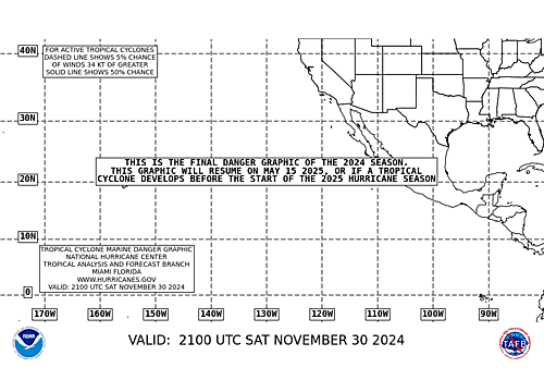
Tropical storm Boris has developed west of Mexico and is current heading west with no threat to land. Winds at 50 MPH are not expected to strengthen, at least not over the next 24 hours. The National Hurricane Center states that the center of this storm is located within a heavy rainfall and convection area indicating that it is already being pulled apart by wind shear.

At the same time, a new tropical depression has developed just west of Boris. Weather Underground reports that this storm is right on the verge of becoming Tropical Storm Cristina. Again the storm track is to the west and should only affect maritime interests.


Tuesday, June 24, 2008

Fengshen heads towards China

UPDATE: AccuWeather is reporting that Fengshen has made landfall just east of Hong Kong. Hong King International Airport is reporting heavy rain with winds of 30 MPH.

Further activity will diminish as the storm moves northward over land. Hopefully, this should be the beginning of the end for Fengshen.
________________________________

Tropical Cyclone Fengshen has been downgraded to a tropical storm for the time being. Sea surface temperatures are very warm in the South China Sea but the wind shear is apparently high enough that further re-development is probably not likely.

Storm tracks I have seen show Fengshen either making landfall on the Chinese coast just east of Hong Kong or turning north and passing through the Strait of Taiwan. Either way, with the slow forward speed of this storm, heavy rains and the potential for flooding is very possible.

One thing that concerns me greatly with a landfall in China is that heavy monsoon rains were causing a lot of flooding in the southern part of China just last week. GDACs was listing this as either an Orange or Red alert area due to the flooding. Additional rain from the cyclone would just worsen the situation should these areas coincide.
Reports are listing a death toll as high as 255 people not including the nearly 700 who may have perished from the overturned ferry. With a death toll of close to 1,000 people, Fengshen is a very dangerous storm despite its low wind intensity.

Sunday, June 22, 2008

Fengshen Brings Destruction in Phillippines

Yesterday, reports indicated that between 17 and 20 people had been killed by Typhoon Fengshen. Reports have steadily shown wind speeds as high as 100 MPH (160 kph) which would make Fengshen a solid Category 2 storm by US measuring standards using the Saffir Simpson Scale.

This morning, Reuters India reports that 155 people have been killed according to the Philippine Red Cross. This number may be increased significantly as there are reports that a ferry capsized killing as many as 700 people.

Photos from AccuWeather "The Weather Matrix Blog" by Jesse Ferrell

When A first read the report to me, our first question was, "Why was a ferry operating during a typhoon?" I know that the Philippines are island nations and I assume that water travel is a way of life. After watching the video below, it seems that the situation is so desperate that the people have no choice but have to get away with no place to go.


This article sheds a little light on the decision making:


Current estimates by the International Red Cross may be severely understated as
more than 700 ferry passengers are feared to have been lost in the typhoon-stricken Philippines. Hopes have begun to fade as only 4 survivors have been discovered.On Saturday, the Philippines became the next victim in what is predicted to be an above average Pacific typhoon (hurricane) season.
Initial observations by regional watch stations predicted that the category 1—with wind gusts of cat. 2 (150 km)—typhoon Fengshen (God of Wind) would cause little damage.
See this news report from Al Jazeera (English) showing the flooding.


The state of Iloilo is to be placed under a state of calamity Iloilo can be seen on the map here as a small island in the central part of the country.

Synopsis from Inquirer.net


At 2:00 p.m. today, Typhoon "FRANK" was located by radar, satellite and surface data at 100 kms South of Baguio City (15.4°N 120.5°E) with maximum sustained winds of 120 kph and gustiness of up to 150 kph. It is forecast to move north
northwest at 15 kph.


Hat tip to Google News for these articles. My intent was to provide a full picture of the destruction that this "low level" storm has caused. It points out that with tropical storm systems, you can never be complacent. We have to watch these systems and be prepared to take action based on what is happening on the ground.

As is typical, there is not a lot of coverage of this storm in the US media (except for the Weather Channel's Tropical Storm Update section at 50 minutes past the hour). I've noticed that the NeoCounter has shown a significant increase in the number of visitors from the Philippines. Please leave some comments describing what is going on. Our prayers and highest hopes are with you all.

Saturday, June 21, 2008

A quick look back and then a gaze into the future

For the past 20 years, Southeast Texas has been my home. I moved down to Orange, TX on the border with Louisiana just over 20 years ago. I went from a suburb in central NJ to small town USA in a place with bayous, alligators and wide open spaces. Within a few months of arriving, Hurricane Gilbert headed our way and there was talk of evacuation and flooding. I even boarded up the windows in my apartment. Over time the place became home.

Then 6 years ago we headed west to the outskirts of Houston alongside Galveston Bay near the Kemah Boardwalk and NASA's Johnson Space Center. Overall this area has offered us a lot and we enjoyed much of it. Now, once again, it is time to move on.

As some of you know, I've accepted a position based outside of Atlanta, Georgia. A and I are going out the first week in July to try to get some house hunting in and then I will drive out on Saturday the 5th. If everything goes as planned, A will be able to get the house squared away and on the market in a few weeks and we will load the crowd up and fly out to Georgia to start over again.
So far trying to get ready has been a whirlwind of activity. Next month will be even crazier but then hopefully everything will settle down to some semblance of normalcy after that.
So, what happens with hurricane tracking? As far as I intend, all will stay the same. If Dr's. Gray and Klotzbach can forecast the Atlantic hurricane season from Colorado, I figure we can track what is happening in the Gulf and Caribbean from northern Georgia.

Hopefully, you all have noticed that we are taking on more of a worldwide view to tropical weather. This weekend we have been watching the path of Typhoon Fengshen (known locally in the Philippines as Typhoon Frank). A tropical wave has been strengthening in the eastern Pacific that looks favorable for further development.
And of course it is always fun to debunk the global warming alarmists using real and complete science to counter their quasi religious preachings.
So regardless of whether we are posting from Texas or Georgia, plan to see the same, hopefully useful, prognostications from this hurricane hobbyist and amateur weather dude. (or is that dud?)
I just hope Texas Fred doesn't make me resign from his blogroll.

Trackposted to Outside the Beltway, The Virtuous Republic, Perri Nelson's Website, Rosemary's Thoughts, Right Truth, Stuck On Stupid, Leaning Straight Up, Cao's Blog, Phastidio.net, Democrat=Socialist, Conservative Cat, Pursuing Holiness, Diary of the Mad Pigeon, Allie is Wired, Nuke Gingrich, third world county, Woman Honor Thyself, McCain Blogs, The World According to Carl, Pirate's Cove, The Pink Flamingo, CORSARI D'ITALIA, Dumb Ox Daily News, , and Right Voices, thanks to Linkfest Haven Deluxe.

Friday, June 20, 2008

Typhoon Fengshen makes landfall


UPDATE: Fengshen is over the Phillipines right now and apparently has decreased in intensity to a tropical storm, possibly even a strong tropical depression. Circulation is staying very organized and once the storm reemerges over water is expected to strengthen. The question at this point is how much? Northward winds are increasing which are acting as a shearing force to break apart Fengshen so the expectation is that he will only strengthen slighly, possibly to a level 1 typhoon. (Source: Weather Underground)

However, the sea temepratures are very warm (> 30C) in the western Pacific around the Philippines and China so the potential exists for significant strengthening if the shearing winds do not develop as expected.

Another key factor which was very interesting to me is that the storm track, originally predicted to turn to the northeast before ever reaching the Philippines, has now been shifted westward. Fengshen is now expected to follow a northwestward track and make landfall in China. The area where Fengshen is likely to make landfall at this time is being inundated with monsoon rain and gale force winds so the addition of this storm regardless of its intensity could be catastrophic.
_______________________________________________________________

From AccuWeather.com


Early Friday morning EDT, Typhoon Fengshen made landfall over the island of
Samar in the eastern Philippines. Maximum sustained winds were 80
mph, the equivalent of a Category 1 hurricane in the Atlantic or Eastern Pacific
basins.

The typhoon smashed into the Philippines' 3rd largest island Friday at Category 1 hurricane strength. Storm tracks now look like the storm will pass directly over the island and over the capital of Manila before turning to the northeast. Due to the interaction with land there is not likely to be any further strengthening but the rainfall may be an issue IMO.


MANILA (AFP) — Typhoon Fengshen smashed into the Philippines' third largest island Friday packing winds of 140 kilometres (87 miles) an hour as residents
braced for flooding, landslides and big waves.


There were no immediate reports of casualties or damage as the storm scythed northwest across Samar, an impoverished island of 1.5 million people.


Its eye was 60 kilometres away from the island's main city Calbayog at 4:00 pm (0800 GMT), the weather office here said.

--snip--

Fengshen was expected to hit the Bicol peninsula on Luzon's southeastern tip on Saturday, and could then hit the Luzon heartland on Sunday, the weather bureau said in an updated forecast.


Arroyo has ordered that warnings be issued to all provinces along the typhoon's expected path, and for local governments to prepare for contingencies, senior aide Anthony Golez said in a statement.


The armed forces were also on "alert in order to support evacuation activities of local government units if needed," Golez said, while the social welfare department was beefing up its relief stockpiles.


The weather bureau, which upgraded Fengshen from a tropical storm on Friday, warned residents of low-lying areas and upland communities to take precautions against flash floods and landslides.


The bureau also said coastal communities could be hit by big waves.


Heavy rains brought by the storm have caused some flooding in parts of the country, but no casualties or damage have been reported.


Hundreds of people die in the Philippines every year due to floods and landslides caused by tropical storms or typhoons that sweep in mainly from the Pacific.


Storm Watch with: Outside the Beltway, The Virtuous Republic, Perri Nelson's Website, Rosemary's Thoughts, Right Truth, Stuck On Stupid, Leaning Straight Up, Democrat=Socialist, Conservative Cat, Pursuing Holiness, Diary of the Mad Pigeon, Allie is Wired, third world county, Nuke Gingrich, McCain Blogs, Woman Honor Thyself, The World According to Carl, Pirate's Cove, The Pink Flamingo, CORSARI D'ITALIA, Dumb Ox Daily News, , and Right Voices, thanks to Linkfest Haven Deluxe.

Wednesday, June 18, 2008

Tropical Storm Fengshen

Typhoon Fengshen UPDATE:

Earlier predictions that Typhoon Fengshen will avoid the Phillipines were a bit "off track", no pun intended. The storm has continued on a westward course despite computer model predictions indicating that it will turn to the north. The northward turn towards Japan is still expected, but a sizable potion of the storm is skirting along the northeastern Phillipine Islands.

Based on the discussion at Weather Underground, a low to mid level pressure ridge is steering the storm to the west. The expectation is that this ridge will be weakening and moving to the east. The result will be for Fengshen to slow and then turn to the north. Interaction with land is also slowing the forward motion of the storm and may reduce the liklihood for further strengthening in the short term.


In the mean while, heavy rains on the islands may cause flooding and potentially mudslides, depending on how long the storm remains over the islands.


_________________________________________________________________


Tropical Storm Fengshen has formed in the eastern Pacific near the Phillipines. Conditions are right for a potential for Fengshen to develop into a typhoon. The current track is expected to take the storm away from the Phillipines but it may affect Japan sometime next week. (AccuWeather.com)

The Japan Meteorological Agency still considers this storm a tropical depression with sustained winds of only 30 kts and gusts of 45. Strengthening is expected over the next 24 hours and typhoon strength winds should be seen after that.

Tuesday, June 17, 2008

New Orleans STILL at risk

BATON ROUGE, La. — Despite a massive effort to repair and upgrade flood defenses
since Hurricane Katrina, storm surge could pour over levees in New Orleans if a
strong Category 2 or higher hurricane strikes the city, the National Oceanic and
Atmospheric Administration said Monday.

While the forecast uses what
officials say is the most accurate and complete picture yet of the region's levee
heights, they said they weren't surprised by findings that reaffirm the area
surrounding New Orleans is among the nation's most hurricane-vulnerable.

IMHO this is outrageous! The Army Corps of Engineers has spent several BILLION dollars, can't give a reasonable accounting for how the money has been spent and the existing levees can only hold back a weak level 2 storm??? As I see it, this is further example of corruption and incompetence in the running of this city, state and everything asociated with it.

On Monday, the corps was unable to provide a breakdown on how much has been spent so far on work to repel storm surge. Since Katrina, Congress has given the corps about $7.1 billion to work with and it is considering giving the corps $5.7 billion
more.

"We have a long way to go," said Randy Cephus, a corps spokesman in New Orleans. "There still remains risk and even once the system is complete, there will always be risk." Before Katrina hit nearly three years ago, levee heights were woefully out-of-date and in many places far lower than officials thought they were, Dokka said.

But, unfortunately, the new measurements, incorporating post-Katrina levee upgrades, confirm an old story: the region remains at risk. "In general, the pattern hasn't changed remarkably," said Stephen Baig, a storm surge expert with NOAA's National Hurricane Center.

"Somewhere between a Category 2 and Category 3 overtopping occurs."
The NOAA storm surge estimates do not take into consideration possible engineering failures, like the levee breaches that caused most of the misery in New Orleans
during Katrina, which was a category 3 upon landfall south of New Orleans.

State officials were not surprised by the latest findings. "All
of coastal Louisiana is vulnerable and will continue to be vulnerable," said
Jerome Zeringue, a top levee aide to Gov. Bobby Jindal.


What really bothers me is that the levees that we are talking about are mounds of dirt covering a concrete core. How do you spend $7 billion on mounds of dirt? We should be installing the high tech, sophisticated flood control systems that are seen in the Netherlands and in the Thames River in the UK. For a major US city to be relying on such an antiquated system is just mind boggling.

Additionally no effort has been made to raise the elevation of the city, least not the 9th Ward where the worst flooding took place.

I'm glad the newest technology was used to measure and model the risk from a storm surge, but the time is well past that updated and new technology is needed to protect against a potential storm. Action is needed, not just wastefulness and then complaining when something goes wrong, especially when the risk is so well known in advance.

Global Warming on Mars


Courtesy of Mallard Fillmore
We've discussed and joked about this in the past:

When the same effect is being seen in multiple independent locations, how can the cause be so totally different. Climate effects seen on other planets show an obvious connection to the Sun as a clear driver.

One thing that would endorse this further - we have been seeing a levelling off and possibly a cooling since 1998 that has been attributed to reduced sunspot activity. As the Sun's influence reaches these outer planets, we should start to detect the same levelling off or cooling effects that we are now experiencing.

Mars, Neptune, Jupiter and even Pluto can act as unperturbed laboratories to prove the effect that the Sun's activity has on climate independent of human influences.

Sunday, June 15, 2008

Evacuation still the best option WHEN REQUIRED

After the evacuation for Hurricane Rita, many people claimed they would never do that again. They would rather ride out the storm than sit in that traffic again. It took me 14 hours to drive a distance than normally took 4. And I think the only reason it wasn't longer was that I met some people who pointed me to a back roads short cut that was empty.

I remember that the same situation existed in 1992 when we evacuated when Hurricane Andrew was heading towards us. At that time the roads out of Orange county to the north were a parking lot so we headed west towards Houston. It took us 4 hours to drive 110 miles while some friend needed the same 4 hours to drive 30 miles. Then the officials in Beaumont said that the next time there was an evacuation, they would block all east west travel and force us into a northward path. I didn't think it was right for Jefferson county bureaucrats to decide the fate of people who lived in the next county over. Fortunately, we didn't have to evacuate again from there until Rita.

I am certain that the same situation existed in New Orleans, Miami, Mobile, Charleston, SC and every other major city faced with an evacuation in the threat of an oncoming storm. That is just reality. Face it folks - we can't get through town in an hour during rush hour let alone during an evacuation. That doesn't eliminate the need to go. It is critical that everyone evacuate when they are told to. Yes the traffic will be bad. Yes it will take longer to get to point B - SO WHAT! This is your life that we are talking about.

AS I pointed out after the hurricane conference last year, the mantra is "Run from the water, hide from the wind." If you live in a storm surge area, you must evacuate at the appropriate time. In the Houston Galveston region, the evacuation order is set up by ZIP codes with those closest to the coast leaving first. It is like unloading an airplane from the back to the front once it lands. It requires some patience, a plan and a cool head.

All of the deaths in the Houston area during the Rita evacuation were a result of the evacuation, not the storm. Changes have been made to the evacuation plan to prevent this type of thing from happening. These changes are good and will certainly help. But there will still be traffic and delays.

And finally, if you are not in an evacuation zone, Please stay put unless there is some overriding reason for you to leave (like you live in a mobile home). During Rita, 3 million people evacuated when only 1.5 million live in the flood zone. This made the evacuation worse than it had to be.

So when the call comes in to leave, be prepared to and go at the appropriate time. If you don't live in a flood area yet you still want to leave, let the rest of us get out first than go while there is still plenty of time before the storm makes landfall.

Preparing with: Pet's Garden Blog, Rosemary's Thoughts, third world county, Nuke Gingrich, McCain Blogs, Woman Honor Thyself, 123beta, Right Truth, Pirate's Cove, The Pink Flamingo, Cao's Blog, , Democrat=Socialist, Conservative Cat, and Pursuing Holiness, thanks to Linkfest Haven Deluxe.

Saturday, June 07, 2008

Call 2-1-1- in Houston Metro Area now for evac assistance later

I first discussed this last year when it was discussed at the Hurricane Conference. Residents in Houston and the surrounding counties of Harris, Galveston and Fort Bend have the opportunity to register to let the officials know if you have any problems with evacuation.

The 2-1-1 Texas United Way Helpline is the only way for people who can’t transport themselves to get a free ticket out of town in an evacuation.

“It’s important to call before the storm so officials can get the correct numbers,” helpline Director David Jobe said last week at a town hall meeting sponsored by Houston District E Councilman Mike Sullivan.

Residents do not need to be bed-ridden or have a debilitating illness to qualify for the service, Jobe said.

Those who have cars in poor condition and even those who just can’t afford fuel for the trip are eligible for assistance.

Anyone who needs this assistance has to register each year so that the officials can have to correct amount of resources available to accommodate everyone. Waiting until a storm is approaching or after you are stuck on your roof is too late.

...officials said that with registration numbers falling each year with the fading memory of Hurricane Katrina, they can’t stress enough the importance of registering for transportation assistance as early as possible.

At 72 hours before a storm, any evacuation assistance must be provided by emergency response officials, Jobe said. And, once that wind hits 55 miles per hour, residents are on their own until the hurricane blows through.

To register with 2-1-1 online, visit www.hcoem.org, and click on the “About 2-1-1” link on the right.


Storm Watch with: A NEWT ONE- NATIONAL EMERGENCY, The Virtuous Republic, Rosemary's Thoughts, Leaning Straight Up, Cao's Blog, Big Dog's Weblog, The Amboy Times, Democrat=Socialist, Conservative Cat, Allie is Wired, Nuke Gingrich, McCain Blogs, Woman Honor Thyself, The World According to Carl, Pirate's Cove, The Pink Flamingo, , and Gone Hollywood, thanks to Linkfest Haven Deluxe.

Wednesday, June 04, 2008

2008 Atlantic Hurricane Season expected to be busy

Additional Information /UPDATE:

Drs. Gray and Klotzback update their predictions for the 2008 Atlantic Hurricane Season.

Tuesday's forecast by William Gray and his team of researchers at Colorado State University calls for a very active season, with 15 named storms, including tropical storm Arthur, which formed on May 31

It is not pointed out, but reading the article you can see that they have deceased their predictions by 2 named storms including one less hurricane as compared to their update in April. As the season progresses the storm predictions can become much more accurate due to improved data.

The predictions coincide with those from NOAA and point to a higher than "normal" level of activity once again. A key point to note is that the prediction is that there is a 69% chance of landfall along the US coast as compared to an average of 52%. This means two things - 1. the risk opf landfall is higher than normal and 2. there is still a 31% chance that there will NOT be a landfalling storm this year. So if a storm does not come ashore, it doesn't mean that the predictions were wrong, they just fell within the statistics.

-------------------------

Once again, a stronger than normal tropical storm season is predicted for 2008. It would be very easy to dismiss these predictions due to the mild seasons we've seen in the past two years. This would be a very foolish thing to do. As the disclaimers at the end of investment commercials point out - past performance is not an indication of future activity - so it is with tropical storm activity.

Source: USA Today
We have to keep in mind how active 2004 and 2005 were and remember that these years were so active primarily because due to the natural cycle of hurricane intensity in the Atlantic - The Atlantic Multidecadal Oscillation. We are still experiencing a time of naturally higher tropical activity and we need to be prepared for the potential for another high activity season.

The Atlantic remains in an extended period of active hurricane seasons that began in 1995, Gerry Bell, lead seasonal hurricane forecaster at the Climate Prediction Center of the National Oceanic and Atmospheric Administration (NOAA), said Thursday.

"People should remember that the 2003-05 seasons saw a total of 31 Atlantic hurricanes," he said. "Although we've had a break the past two years, there's no reason to think that break will continue."

NOAA forecasters predict a 60%-70% likelihood of 12-16 storms strong enough to be named, meaning sustained winds of at least 39 mph. They expect six to nine to develop into hurricanes — storms with winds reaching 74 mph. Of those, the forecast says, two to five are likely to be classified as major, with winds of 111 mph or higher.

Since 1950, an average Atlantic hurricane season has 11 named storms, six of them hurricanes.

Last year, the number of named storms actually reached the predicted number for the season but the number of hurricanes were below that predicted. The season seemed mild because none of those storms came ashore in the US. El Nino conditions generally kept the storm intensity low and high pressure kept the storms out to sea. 2006 was even more obvious with nearly every storm being pushed into the center of the North Atlantic before dying out.

Another factor that affects the level of activity and the storm intensity is the amount of wind shear. In 2006 most of the storms that did form were ripped apart by wind shear before they could strengthen. Interestingly enough, work by Kerry Emmanuel of MIT and other are now indicating that one possible effect of global warming may be that there are fewer tropical storms due to an increase in wind shear. This flies in the face of those who had predicted many Katrina type storms due to the increase in sea surface temperatures.

When Cyclone Nargis ripped through Myanmar, former VP Al Gore immediately screamed that it was due to global warming. Of course, no comment was made accounting for the fact that he had to wait 3 years since Katrina before he could again make that claim. Keep in mind also that the computer models that were used to predict catastrophic hurricane due to global warming are now predicting the opposite as new data and understanding is incorporated. A model is a great tool, but it is only as good as the data from which it is constructed. Empirical observations show that the number and intensity of hurricanes are well within historical norms.

What all this means, quite simply, is that we are still experiencing a period of naturally occurring, increased hurricane activity. Some mitigating factors may make one or two seasons seem more mild that the others but we must still be prepared. Remember when Andrew came ashore, it was a Cat 5 and it was already September. Only one storm that year but it was a doozy. In being prepared, we can react appropriately to stock up as needed, evacuate if necessary and hunker down as appropriate.

Storm Watch with: Outside the Beltway, Rosemary's Thoughts, 123beta, Right Truth, Big Dog's Weblog, Leaning Straight Up, Cao's Blog, The Amboy Times, Democrat=Socialist, Conservative Cat, Allie is Wired, third world county, Woman Honor Thyself, McCain Blogs, The World According to Carl, Pirate's Cove, The Pink Flamingo, Wolf Pangloss, , Right Voices, and The Yankee Sailor, thanks to Linkfest Haven Deluxe.

Monday, June 02, 2008

Hurricane Preparedness

National Hurricane Preparedness Week was May 25th through May 31st, the week before hurricane season started in the Atlantic and Western Pacific. (Hurricane season actually starts mid May in the Eastern Pacific). That was last week, but if you were like me and many others, the cooler than normal weather kept your mind off of tropical weather and thinking more of winter or spring than the scourge of summer.

So now we have a choice. We could so nothing and drown - or panic as we try to get out of town with a storm bearing down on us, or we can be prepared. Of course nobody knows if a tropical storm or hurricane will make landfall in our area, but that is why it is so important to be prepared. To be ready if a storm approaches.

The National Hurricane Center has an excellent presentation on Hurricane Preparedness which I will attempt to summarize here. I strongly recommend you look it over to learn more about these storms, learn more about the potential dangers and understand how to prepare and respond if necessary. When you are prepared, panic becomes a non option and the process works much better. When panic sets in, people get hurt or killed, tensions run high and the lack of preparation just adds to the misery of everyone involved.

Part I: The Basics

The ingredients for a hurricane include a pre-existing weather disturbance, warm tropical oceans, moisture, and relatively light winds aloft. If the right conditions persist long enough, they can combine to produce the violent winds, incredible waves, torrential rains, and floods we associate with this phenomenon.

Each year, an average of eleven tropical storms develop over the Atlantic Ocean, Caribbean Sea, and Gulf of Mexico. Many of these remain over the ocean and never impact the U.S. coastline. Six of these storms become hurricanes each year. In an average 3-year period, roughly five hurricanes strike the US coastline, killing approximately 50 to 100 people anywhere from Texas to Maine. Of these, two are typically "major" or "intense" hurricanes (a category 3 or higher storm on the Saffir-Simpson Hurricane Scale).


Part II: History

One good thing about a tropical system is usually, you can see it coming from a distance and get out of the way. The most deadly storms, though, are those which were not known to be as bad as they turned out to be such as the 1900 Storm in Galveston or those low intensity Tropical Storms that are so slow moving they cause several feet of flooding such as Tropical Storm Allison which hit Houston in 2001.

The listing of many of the worst storms throughout history illustrates some of the dangers that these storms pose. The worst case is discounting a storm because it is "just a tropical storm or a category 1 that causes a lot of flooding because it is slow moving. Likewise, you cannot evacuate every time it gets cloudy. Learning from past storms tracks and understanding how these storms form can help to understand the forecasts and what goes into the calls to evacuate or stay put.

Part III: Storm Surge

The majority of deaths are caused by the storm surge. In flat coastal areas, the surge can be excessive resulting in much flooding which can lead to drownings and can cause a greater level of destruction of structures along the shore.
Storm surge is simply water that is pushed toward the shore by the force of the winds swirling around the storm. This advancing surge combines with the normal tides to create the hurricane storm tide, which can increase the mean water level 15 feet or more. In addition, wind driven waves are superimposed on the storm tide. This rise in water level can cause severe flooding in coastal areas, particularly when the storm tide coincides with the normal high tides. Because much of the United States' densely populated Atlantic and Gulf Coast coastlines lie less than 10 feet above mean sea level, the danger from storm tides is tremendous.
Storm surge is the most dangerous effect of tropical storms. After Hurricane Rita showed the hazards of evacuating too many people from a given area (3 million left when only 1.2 live in the flood plain), the Texas Emergency Management adopted the plan, "Run from the water, Hide from the wind." Quite simply put, you can hunker down as long as you are on high ground but you cannot hide from the rising waters unless you leave.

Part IV: Marine Safety

Quite simply for us pleasure boaters...STAY OUT OF THE WATER WHEN A STORM APPROACHES!

That is the easiest rule to remember. For those who don't have that luxury - The Navy, commercial fishermen, tankers, freighters and the brave Coast Guard who are rescuing our sorry backsides when we didn't listen to the harbor master - there are tools to help predict and deal with an approaching storm. One of those tools - the Mariner's 1-2-3 Rule was a featured graphic on this site during last season.

Part V: High Winds:

As I said earlier, you can safely hide from the wind. The important thing is to secure ALL loose items preferably by bringing them inside. Any loose item will become a lethal missile in 110 MPH winds. A friend of mine came back to his house in Orange to find that the windows had shattered into shards that were embedded into the floor with obvious force.

The forces imparted by the winds increase exponentially with increasing speeds. So a Category 4 storm will have over 100 times the destructive force of a Category 1 storm. Tropical storm force winds can still be a hazard to anyone caught in them so evacuations are done such that everyone is out of the area before the tropical storm winds hit the area rather than waiting until the hurricane winds hit the area.

Because of the errors inherent in track predictions, this may sometimes result in an area being evacuated and the storm suddenly changes course. The evacuation area has to take into account the full possible storm track even if some people leave when no storm went in this area. This happened when we evacuated during Andrew in 1992. We left and fought the traffic and had a restless night in a hotel only to find out that the storm turned right and went into Louisiana. When I complained that we shouldn't have bothered to leave my wife asked if I'd rather we ended up as a statistic if the storm did what it was supposed to do. I think that sums it up - We need to follow the advice of the authorities because they have the best information and the training to make the most accurate predictions keeping in mind that nothing is exact.

Part VI: Tornadoes and Part VII: Inland Flooding

Flooding causes more deaths than anything else.
"In the 1970s, '80s, and '90s, inland flooding was responsible for more than half of the deaths associated with tropical cyclones in the United States."
Ed Rappaport
National Hurricane Center
Not only is inland flooding a concern but the intense NE quadrant of a storm often contains tornadoes which cause even more destruction.

Tornado Facts

  • When associated with hurricanes, tornadoes are not usually accompanied by hail or a lot of lightning, clues that citizens in other parts of the country watch for.

  • Tornado production can occur for days after landfall when the tropical cyclone remnants maintain an identifiable low pressure circulation.

  • They can also develop at any time of the day or night during landfall. However, by 12 hours after landfall, tornadoes tend to occur mainly during daytime hours.

What makes all of this worse is that the areas that are seeing the inland flooding and increased risk of tornado formation are the same areas where those of us evacuating are fleeing to. So just because you've evacuated, don't think you can let your guard down. Until the storm dissipates it is important to maintain an alert focus on the conditions around and respond appropriately.

And finally Forecasting:

The best thing you can do is READ THIS BLOG!! I think so anyway.

But seriously, find a resource that provides detailed information for your area. I try to provide as many links as practical along with the weather services listed in the sidebar. Read up on the forecasts and developing storms as they form. The Weather Channel provides hourly tropical weather forecasts 50 minutes after every hour. Stay aware especially as the season progresses and activity picks up during the summer months.

And heed the warnings of the local emergency officials. Their advice will provide the safest option yet. If something isn't perfect then complain afterwards and offer suggestions for improvement AFTER the fact. Don't refuse to evacuate only to be sorry later.

Being Prepared: Rosemary's Thoughts, 123beta, Maggie's Notebook, Adam's Blog, Right Truth, The Amboy Times, Leaning Straight Up, Democrat=Socialist, third world county, Woman Honor Thyself, McCain Blogs, DragonLady's World, The World According to Carl, Blue Star Chronicles, Pirate's Cove, The Pink Flamingo, Dumb Ox Daily News, CORSARI D'ITALIA, , and Right Voices, thanks to Linkfest Haven Deluxe.

2010 Atlantic Hurricanes (courtesy of Weatherstreet.com)

NOAA Gulf of Mexico Radar (courtesy of Weatherstreet.com)

NOAA West Atlantic & Caribbean Radar (courtesy of Weatherstreet.com)

NOAA East Atlantic Radar (courtesy of Weatherstreet.com)