Gulf Coast Hurricane Tracker

A single source reference on tropical weather predictions. With a traditional focus on the upper Texas and Louisiana Gulf Coast we've maintained links to track all Atlantic Basin, Caribbean and eastern Pacific storm systems. We are now expanding our view to tropical storms throughout the world intending to be a comprehensive global storm tracking resource.

Friday, September 26, 2008

No name storm


A storm system has come ashore in South Carolina. Currently heading to the west but expected to move north throughout the day. This storm has no name.

Winds have been recorded as high as 60 mph yesterday. There is an obvious center of circulation and the origin was tropical. yet for some reason the weather services are not considering this a tropical storm. In all of the discussions regarding Tropical Storm Kyle, I thought they were talking about no-name here. Instead they really meant the storm that is heading north from The Dominican Republic and is expected to soak the northeast this weekend and early next week. That will certainly be a major weather issue but we should not ignore the situation at hand in the southeast either.

This system is probably officially a depression. I guess the big question is whether it is tropical in nature or not. I do not know what would make a system as well defined as this not be tropical exspecially with origins in the Caribbean.

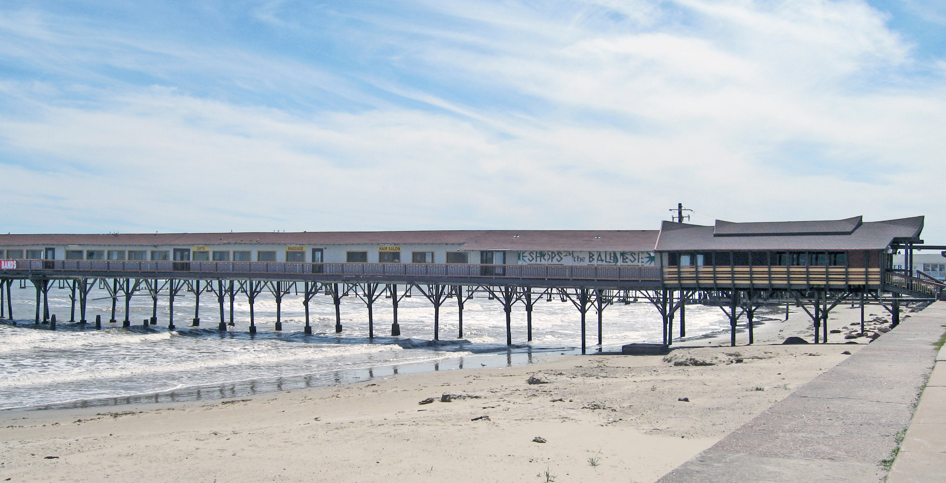
The key thing is that the North Caroline, South Carolina and Georgia costs have soem very high waves and the potential for strong rip currents. Rainfall in South Carolina may be heavy in spots although I do not think it will be such that there will be flooding concerns.

Unfortunately, once again a system is close enough to bring hope to us in the dry north Georgia hills but the forecast is for some light showers at best. Lake Lanier is close to 18 feet below normal. We could use a good drenching from asystem like this.


From the National Hurricane Center:

1. THE WELL-DEFINED NON-TROPICAL LOW PRESSURE SYSTEM IS NOW OCATED OVER CENTRAL SOUTH CAROLINA AND CONTINUES TO MOVE FARTHER INLAND. STRONG WINDS...COASTAL FLOODING...HIGH SURF...AND DANGEROUS RIP CURRENTS WILL GRADUALLY SUBSIDE ALONG THE COASTS OF NORTH AND SOUTH CAROLINA TODAY...BUT COULD CONTINUE ALONG PORTIONS OF THE U.S.MID-ATLANTIC COAST DURING THE NEXT DAY OR TWO.

INTERESTS ALONG THE U.S. EAST COAST FROM THE MID-ATLANTIC REGION NORTHWARD TO NEW ENGLAND SHOULD MONITOR STATEMENTS FROM THEIR LOCAL NATIONAL WEATHER SERVICE FORECAST OFFICES...AND ALSO HIGH SEAS FORECASTS ISSUED BYTHE OCEAN PREDICTION CENTER FOR ADDITIONAL INFORMATION AND WARNINGS.

Monday, September 22, 2008

Phillipines lashed by Typhoon Hagupit (Nina)

UPDATE: Typhoon Nears Landfall in China (from AccuWeather)

Typhoon Hagupit is within hours of slamming into extreme southern China. The typhoon will blast onshore southwest of Hong Kong, near the city of Zhanjiang, this evening (Eastern time). The typhoon's intensity will be equivalent to a Category 3 or a strong Category 2 hurricane at landfall. Destructive winds will accompany Hagupit through extreme southern China. A wider area of southern China and northern Vietnam will be pounded by the typhoon's flooding rain.

Story by AccuWeather.com Meteorologist Kristina Pydynowski


A Category 3 typhoon lashed the central and southern Philippines with heavy rain and winds killing one person and displacing about 2,000 others.

One person has been killed and about two thousand others displaced as Typhoon Hagupit battered the central and southern Philippines with heavy rain. Ferry services have been suspended and fishing craft have been barred from setting sail.Meanwhile Taiwan has issued land and sea warnings as typhoon Hagupit heads towards its southern coast.Hagupit is expected to brush Taiwan overnight, bringing sustained winds of up to 144 km/h. (Radio Australia)

Typhoon ‘Nina’ leaves 4 dead (Philippine Star)

The Philippines and south China have had several strong typhoons this season with many people killed and heavy flooding.

Hagupit is not heading for Taiwan, Hong Kong and south China with winds expected to reach as high as Cat 4 before making landfall.

Hong Kong May Hoist Signal No. 8 as Storm Approaches (Bloomberg)

Typhoon Hagupit nears China's southern coast (China Daily)

FUZHOU -- Hagupit, the 14th typhoon to affect China this year, is poised for landfall in the southern Guangdong Province early on Wednesday, meteorological stations in Fujian and Guangdong provinces warned on Monday.

The eye of the storm was located 480 km southeast of Hengchun City in Taiwan at 5 a.m. Monday, packing up winds of hurricane force at 137 kilometers per hour in the center, said the observatory in Fujian.

It forecast the typhoon moving at 20 to 25 km per hour would begin to affect coastal cities of Xiamen, Zhangzhou and Quanzhou with strong winds and heavy rains from Tuesday. However, the typhoon's possible landing path would be in the neighboring province of Guangdong.

The meteorological station in Guangdong forecast that Hagupit would make a landfall on Wednesday morning, before which the province would be dominated by a heat wave with daily high temperatures of 35 to 37 degrees Celsius.

Aftermath

It's been 10 days since Hurricane Ike slammed into Galveston with a 15 foot storm surge and 110 MPH winds. For people on the island, time has stood still. From here in North Georgia, I cannot comprehend the situation. I see areas that were home for 6 years and can't believe what I see. Other areas that were home for over 14 years are just as bad or worse.

Fortunately for us, the house wasn't damaged. But just a couple of miles to the east, everything else was. The Kemah Boardwalk was torn apart. I always understood that the boards were designed to break away in a bad storm to leave the framework behind. I think the storm surge was too great even for the framework. It was good to hear Mr. Fertitta say that he expected a storm like Ike would come some day and he will rebuild.

Landry's Restaurant in Kemah was able to claim that it survived hurricanes for over 100 years without a scratch. Not anymore. Landry's flooded and the ground floor was gutted.

Todville Rd. in Seabrook is to the left. I drove on this road every day. Even though flooding was common there, it is still unsettling to see so much water flooding these expensive homes.

The Island is even worse. The Balinese Room was a landmark. An old speakeasy from the 1920's that saw performers such as Frank Sinatra. A gambling hall like one straight out of the movies with game tables that converted to regular dining table when the warning came in that the "coppers" were at the door. The long pier provided time to rearrange everything to look legit before anything was discovered. It is gone...completely. One news reporter suggested that maybe it could be rebuilt. Well a new building could be erected, a new Hooters can be added next door to replace the one that was blown away too, but the history can never be replaced.


Galveston tried a look and leave policy early this week and had to cancel it within a few hours because the traffic was backed up over 10 miles. The city has been asking for one additional week to get some systems and some of the infrastructure working before people return. Today I saw that the city is allowing a "look & leave" for the West End now. I still have not seen how the west end has fared. Are many homes left? The beach houses and light sand was beautiful. I wonder now what is left.

Surfside Beach is a small community that was under 4 feet of water the day before the rain and wind even started. Authorities were able to force everyone out with the exception of one man who admitted that staying was "just plain stupid." The Weather Channel was expecting that once Ike came ashore there would be no more town. I think Ike moved just east enough that Surfside is still there but badly beaten.

Bolivar Peninsula is on the other side side of Galveston, across a straight known as Bolivar Roads, was essentially wiped clean. A few homes remain including one that got some special attention because it was rebuilt after Rita to withstand a Cat 5 storm. A moonscape exists around it.

Further east in Orange, caskets were unearthed in one cemetery. A levee broke on the Sabine River and flooded down town. Bridge City had 8 feet of water in it. The storm surge hit all the way easy to Alabama flooding New Orleans and Lake Charles, LA. Several hundred people had to be rescued in Louisiana even though the storm came ashore in Texas. Because of the physical size of Ike, the storm surge was nearly that expected for a Cat 4 storm even though Ike's winds almost reached a Cat 3 (1 mph short). Never before has a storm affected such a broad area of coastline at one one time.

Right now it is believed that approximately 61 people have died due to Ike. Approximately 50 people are missing. With the number of people who stayed behind, I can't help but wonder if these numbers will climb much higher.

I've avoided posting on recovery efforts because so much is happening so quickly and I am so far removed that I don't want to risk publishing information that is incorrect or out of date. It feels weird when I look at pictures or read the news. I am learning to make Georgia my new home but Galveston and Orange will always be special places to me, where family and friends struggle with recovery.

So I ask that for everyone who lost so much and for everyone who was lost -- pray.

Storm Watch with: Mark My Words, Rosemary's Thoughts, A Blog For All, Right Truth, DragonLady's World, Shadowscope, Leaning Straight Up, Cao's Blog, NN&V, Democrat=Socialist, Diary of the Mad Pigeon, , third world county, Woman Honor Thyself, The World According to Carl, The Pink Flamingo, WingLeSS, CORSARI D'ITALIA, and Stageleft, thanks to Linkfest Haven Deluxe.

Saturday, September 13, 2008

Galveston after Ike (Houston Chronicle)


Downtown Houston after Ike (Houston Chronicle)

News conference by Houston Mayor Bill White

The following information was communicated by Mayor Bill White who requested spreading the word to anyone who may have not heard it because of loss of power or other reasons. If you are on a laptop and read this, pass the word along to others.

1. Stay off the road

The Houston Police Chief is driving around assessing the damage. Too many people are out on the road. People are driving around and getting stuck and then needing help. You should not go out unless you have a vehicle capable of handling high water. Even then some high water vehicles are getting stuck as well. In some cases the debris is making roads impassable regardless of the water level.

2. Drink bottled water

The Houston municipal water system pressure has dropped low enough to present the possibility of back flow of water from outside the system. There is no evidence of contamination To play it safe, the mayor recommends drinking bottled water. If you do not have bottles water, then boil the tap water for one minute as a precaution.

3. Conserve water

The less water is used the sooner the system pressure may be brought up to acceptable levels. If you don't need a bath right now don't take a bath right now.

Hurricane Ike comes ashore

Hurricane Ike came ashore in Galveston at 2:10 am local time. With 110 MPH winds Ike was technically a Cat 2 storm, only 1 MPH away from Cat 3 as if that would make a difference. The effects of the storm surge were seen from early afternoon with flooding all along Galveston Island and Galveston Bay as well as storm surge flooding all the way to Alabama.

This storm was so huge that while the winds were Cat 2/3 the storm surge level was equivalent to a Cat 4/5.


As Ike came ashore, news reports by The Weather Channel and by KHOU Houston both showed how the eye tightened up as Ike approached the shoreline. The eye measured over 80 miles wide earlier in the evening but by midnight the eye diameter had dropped to half that indicating some significant strengthening. The storm was also becoming more organized as it approached land. I think that the reason the winds had not picked up was because of the interaction with land.

Hurricane Ike Makes Landfall Over Galveston (The Weather Channel)
Ike made landfall at 2:10 a.m. CDT at Galveston, Texas, with maximum sustained winds near 110 miles per hour. Its minimum pressure was 951.6 millibars, reported by the barometer at the Galveston Pleasure Pier when the center passed overhead.


A few posts down I have buoy reading. The fist plot is for a buoy several miles out that Ike obviously passed directly over. Apparently it damaged the buoy after recording 120 MPH winds because the readings have stopped. The other two plots show the storm passing overhead but not at the eye as the wind speed and pressure do not reach the same levels.

Ike Roars Ashore in Galveston, Weakens to Category 1 Storm as Millions Lose Power(Fox News)

GALVESTON, Texas — Massive Hurricane Ike weakened to a Category 1 storm Saturday morning after ravaging southeast Texas and battering the coast with driving rain and ferocious wind gusts as residents who decided too late they should have heeded calls to evacuate made futile calls for rescue.


While Ike is finally slowing down, it is still causing problems. The surf at Galveston is rougher than I have ever seen it, floooding is everywhere and Ike will probably stay a hurricane or a strong Tropical Storm all teh way until it reaches Dallas.

People to the north need to prepare by securing loose items or bringing them inside and stay away from windows.

Friday, September 12, 2008

Too late to leave - STAY PUT

Local authorities are now warning residents to stay put and hunker down. It is too late to leave and officials want people to stay off the roads. Most communities have curfews, some from dusk to dawn and others from 11pm or so until 5 am.

At this point the only safe option is to find an interior room, prefereably a closet or bathroom. A smaller room is more sturdy. If you can, place mattresses against the walls for added protection.

If you still have running water, fill up the bathtub for drinking and cleaning.

Once the storm starts, do not open the doors or look out.

Don't be fooled by the calm of the eye. If the eye passes overhead, the storm will suddenlt die down for a brief period of time then suddenly the winds will hit with full force in the opposite direction and without warning. If you are outside when the eyewall hits you will be in trouble.

Pictures of Ike this afternoon

Two of my son Michael's friends took some pictures in Kemah Texas (right on Galveston Bay) and at Seawall Blvd in Galveston.

From Shannon: (Kemah)


This is the Kemah Boardwalk. Those white topped poles are street lights that line the boardwalk along the restaurants. It is completely underwater.


T-Bone Tom's Restaurant along State Highway 146 in Kemah


From Dannie Marie:

Waves hitting the Galveston Seawall


Flagship Hotel: A hotel from the 40's that is on a pier over the Gulf of Mexico.

Local hurricane coverage from KHOU on Direct TV

Direct TV is now broadcasting KHOU Channel 11 from Houston live on Channel 361. KHOU can also be heard on XM satellite radio.

KHOU Channel 11 Houston website.

Geraldo Rivera gets knocked down by storm surge in Galveston

Winds And Seas Increasing On Coast As Ike Approaches

NEWS ALERT: Due to current conditions, Galveston County can no longer facilitate general evacuations. Individuals who can still safely evacuate should do so immediately. Otherwise, shelter in place. Galveston County Emergency Ops: 888-384-2000.

Report from Newsradio 740 KRTH:

The landfall location will probably be very close to the southwest end of Galveston Island. A strike in this portion of the Texas coast will provide dangerous, perhaps life-threatening impacts.

Forecasters say because of Ike's size and the shallow Texas coastal waters, it could produce a wall of water 20 feet high, and waves of perhaps 50 feet. The inundation may be locally catastrophic.

Ike is a category 2 hurricane, and some strengthening is forecast during the hours ahead. Ike could become a major hurricane before reaching the coast. Ike is expected to produce rainfall of 5 to 10 inches with isolated amounts of 15 inches possible. Isolated tornadoes are also possible tonight over portions of southeastern Texas.

Hurricane-force winds extend outward up to 120 miles from the center, and tropical storm-force winds extend outward up to 275 miles.

MANDATORY EVACUATION ZIP CODES: 77058, 77059, 77062, 77520, 77546, 77571, 77586, 77598

For the very latest information, see The Weather Channel Update and listen to continuing coverage on NewsRadio 740 KTRH.

Massive storm surge possible

The data plotted in the post below for the buoy marker furthest out shows a recorded wind speed of 110 mph. Since sustained wind speed and gusts are not plotted separately on these graphs, there is no way to tell if this is a steady 110 or just a puff.

Either way these winds are very strong and will cause great damage both from the wind pressure against windows and structures and from flying debris. If you haven't done so already, please bring anything loose indoors or secure it firmly so it cannot blow around. This includes grills, potted plants, wind chimes, rain gauges and anything else that could be out on the porch that we just wouldn't give another thought to.

A bigger danger than the wind is the water. The storm surge that is being discussed for Galveston is AT LEAST 20 feet high. This morning Fox News crawler stated that a 50 foot wall of water could hit shore and then travel up Galveston Bay. Now I see that it says 20 feet. Both are dangerous and destructive. The sea wall in Galveston is only 17 feet high and that doesn't take into account all the sand that has build up along the bas of the sea wall over the years. In some places I suspect that there is really only protection against a 10 - 15 foot wave height.

This morning, a good 15 hours or more before landfall is expected, water levels in Surfside (just south of Galveston) are 4 feet and higher already. News reports showing the surf in Galveston reveal waves breaking over the sea wall.

Deadly Wall of Water Reaching Texas (AccuWeather)

Winds will continue to intensify through Saturday, gusting over 100 mph in Houston, Galveston and surrounding areas. Mobile homes will be demolished, most homes will suffer major damage, and even homes built to withstand hurricanes could be damaged.

The skyline of Houston will be blasted by hurricane-strength winds, which will cause significant glass damage. Seven out of the 10 tallest buildings in Texas are in downtown Houston, the nation's fourth largest city, and 28 buildings stand over 500 feet tall.

Torrential rain and tornadoes will add to the devastation from the upper Texas coast to the Mississippi Valley. As much as a foot of rain will spark dangerous flooding and flash flooding across Texas as Ike moves to the north after landfall.


The National Hurricane Center is warning coastal residents whom have chosen to stay behind that they face certain death from the storm surge. It was pointed out last night that even an Olympic swimmer like Michael Phelps cannot outswim the rip currents that are now plaguing the gulf coast from Florida to Texas. If you get caught up in the surf there is little that you can do to be rescued. This is dangerous.

Ike Brings Dangerous Surge (The Weather Channel Video)

Last Night in Galveston: Big waves already (The Weather Channel Video)

Tropical Update (9/12/08 9:50 am) (The Weatehr Channel Video)

Thursday, September 11, 2008

Windspeed and Pressure as Ike approaches landfall

The following charts are plots of wind speed and air pressure as recorded by the buoys in the Gulf of Mexico off the coast of Galveston. These plots are ordered in the direction towards the shoreline and if I chose them correctly they will show the actual wind speed and pressure of Ike as he crosses over them towards the Island. Clicking on each plot should enlarge it to full size.


Station 42361 - Auger - Garden Banks 426

Station operated by Shell International E&P
Fixed Drilling Platform
27.550 N 92.490 W (27°33'0" N 92°29'24" W)


Station 42047 - HI-A389 TABS V

Developed and maintained by Texas A & M University
Funding provided by Flower Garden Banks Joint Industry Project

TABS II
27.897 N 93.597 W (27°53'48" N 93°35'50" W)


Station 42043 - GA-252 TABS B

Developed and maintained by Texas A & M University
Funding provided by the Texas General Land Office's Oil Spill Prevention & Response Program

TABS II
28.982 N 94.919 W (28°58'55" N 94°55'7" W)


Plan on heavy damage in Galveston and Brazoria Counties


Hurricane Ike will pack a wallop regardless, and could become a very serious storm before landfall occurs in the predawn hours of Saturday. There is some question as to whether the storm will be a Category 3 or 4 hurricane when it hits but, regardless, it's going to get real nasty along the mid- and upper Texas coast. The storm will produce major damage throughout much of eastern Texas this weekend, and a small section of the coast could be completely devastated.

Story by AccuWeather.com Senior Meteorologist John Kocet.

I am not trying to be overly dramatic here - just trying to get the message across that In My Opinion, everyone in the evacuation areas of Galveston and Brazoria Counties should be evacuating.

This hurricane has been very unpredictable in its path. All week the projected track continued to shift south and west first towards Corpus Christi and then further towards Brownsville. The idea that Ike could make landfall in northern Mexico was a real possibility. Yesterday the storm track changed direction and started to shift towards the north and east. Last night I noticed that Galveston was right in the bulk of the cone of uncertainty. This morning it was clear that Ike was coming ashore just west of Galveston; the worst possible track position for Galveston/Houston.

As sudden as this course change has occurred, it seems to me that we may have missed the window in ensuring that the everyone who should evacuate actually is able to. If you are in an evacuation zone - get out ASAP.

Tropical Storm force winds will be coming ashore by mid day tomorrow (Friday) and the roads should be empty by then. So far the freeways are flowing smoothly but I would expect traffic to build up rapidly tonight and tomorrow morning.

Live Houston Traffic Map from Houston TranStar I recommend checking the live map at this link before heading out. It is the most accurate and easy to read traffic map I have ever used and is a good way to plan your trip before heading out. Right now (3:30 CDT Thursday) outbound lanes of the North Freeway (IH-45N) and the Northwest Freeway (US 290) are backing up with the start of afternoon rush hour traffic mixed with some people leaving. Be prepared that the traffic can and will likely get worse over the next 24 hours.

Immediate mandatory evacuation of Galveston Island (Link to KHOU)

Mandatory Evacuations Ordered, Hurricane Warning Issued for Louisiana and Texas Ahead of Ike (Fox News)


GALVESTON, Texas — The mayor of Galveston ordered a mandatory evacuation of
Galveston Island Thursday and a hurricane warning was issued from Louisiana through most of the Lone Star State's coast as Ike continued to close in on the region.

Mayor Lyda Ann Thomas ordered everyone off the island. Galveston, which is home to about 58,000 people, won't open shelters.

Mandatory evacuation orders were issued for tens of thousands of people in low-lying areas in Harris County, where Houston is located.

And Jefferson and Orange counties, between Houston and the Louisiana state line, in addition to San Patricio County were also ordered to evacuate. More than 325,000 people live in the two counties.

Mandatory Evacuation called for Jefferson and Orange Counties (Beaumont Enterprise)

A mandatory evacuation has been called for Jefferson and Orange counties at 6
a.m. to-day, according to information from the emergency management officials.

Hurricane Ike's track has been moving more north during the night and state officials will be sending resources, including buses to help with the evacuation.


Orange County Information (KOGT 1600 AM)

Ike heading near Galveston

The storm track for Hurricane Ike continues to shift to the north. Ike now appears to be headed for landfall somewhere between matagorda Bay and Galveston. This places extreamly heavy winds and rain going right over the I-45 corridor. Galveston, Texas City, League City, Houston and many towns in between will be hit hard with the "dirty" side of the storm.

A hurricane watch extends from Port Mansfield, Texas, to Cameron, La., as Hurricane Ike churns through the Gulf of Mexico. The storm will pose a serious threat to lives and property as it blasts onshore in between Matagorda and Galveston Friday night.


Residents in zip code zones A and B are being ordered to evacuate beginning noon today (Thursday).

Currently Ike is a Category 2 storm with 100 MPH winds. The problem is that the central pressure is being measured very low - around 950 mbar and slowly dropping. This pressure is more in line with a Category 3 storm and the concern is that Ike will tighten up as he approaches land. AccuWeather meteorologist Joe Bastardi is comparing the conditions that we are seeign with Ike to thiose observed with both Hugo in 1989 and Carla in 1969. Weather Channel meteorologist Jim Cantore also compared the current storm intensity and track with Carla and also the great storm of 1900 in which Galveston was essentially wiped out.

Galveston Evacuation News Conference (KHOU) (Sept 10, 2008) Audio is soft

Hurricane force winds are expected to reach Galveston and Houston by late Friday night and early Saturday morning. Water levels will begin increasing Thursday before the rain from the outer band arrive.

Anyone who has not left before Friday morning needs to shelter in place. Secure any loose articles outside. Find an inside room with no windows to stay in while the storm passes and remian there until the storm is completely past. Do not let the relative calm of the eye trick you into thinking that it all clear. At 7 mph forward speed, Ike is a slow moving storm that will take quite a while before it passes any given area.

Wednesday, September 10, 2008

Texas begins evacuations; Ike's track shifts to the north

This morning, communities along the Texas coast began voluntary and mandatory evacuations. Low lying areas at the western end of Galveston Island, Brazoria County and areas south to Corpus Christi began transporting high needs people on buses and ordering voluntary evacuations in some areas. My day was so full today that I did not have much opportunity to check on this storm let alone update my prognostications.

Weather Channel Tropical Update 7:50 pm

Tonight I finally had a chance to turn on the Weather Channel and I see that Hurricane Ike's track has shifted to the north towards Houston. Additionally expectations are that Ike will increase to at least a mid Cat 3 and could even intensify to a Cat 4 storm before making landfall.

I am especially concerned by a comment by The Weather Channel's Jim Cantore in which he expressed concern that we may be past the time where a mandatory evacuation could be ordered. Comments now are focused on hunkering down to ride out this storm.

If Ike does indeed grow to be a level 4 storm, the effects could be felt along the entire coast from New Orleans to Mexico from the storm surge and as far inland as Dallas if past storms such as Carla are an indication.

For everyone in low lying areas, I recommend strongly that you follow the guidance of area officials and evacuate as soon as your area is told to do so. If you are not in an area that is asked to evacuate, officials are askign that you stay and shelter in place. The worst thing to happen would be if everyone tried to leave at once and blocked the freeways as we had with the evacuation ahead of Hurricane Rita in 2005.


Galveston County: More mandatory evacuations ordered: Low-lying West End under mandatory evac order; rest of Galveston voluntary evacuation (KHOU)

Brazoria County: Mandatory evacuation called for most of the county (KHOU)

Chambers County: Evacuations ordered for Galveston Bay, Trinity Bay residents (KHOU)

Most of Texas Coast under Hurricane Watch (Houston Chronicle)

— The National Hurricane Center has placed much of the Texas Gulf Coast under a hurricane watch as Hurricane Ike churns toward the state.

The watch extends from Cameron, La., to Port Mansfield, almost 45 miles north of
Brownsville. Forecasters said hurricane conditions were possible within the watch area by Friday.

As of 4 p.m. CDT, the hurricane was centered about 720 miles east of Brownsville and was moving northwestward at near 8 mph. Maximum sustained winds were near 100 mph with higher gusts and hurricane-force winds extending outward up to 90 miles from the center. Tropical storm strength winds of 39 to 75 mph extend outward from the center for up to 205 miles.

Tuesday, September 09, 2008

Welcome to a new blogger

Hey everybody,

I'd like to welcome a new blogger to our corner of the blogoverse.

Silence is Gone

This is a new free flowing blog of ideas from my one and only.

Stop by and see what A has to say each day. Her blog will be poetry, commentary, thoughts, rants, whatever comes to mind.

I've commeted for two years how much I've enjoyed blogging and that I've met some really neat people out here I like to call friends. Visit her site and leave a short note. Let her know what you think.


Trackposted to No Apology, http://morewhat.com/wordpress/?p=3137, Mark My Words, Rosemary's Thoughts, Right Truth, Dollar Traveler, Shadowscope, DragonLady's World, , The Amboy Times, Leaning Straight Up, Cao's Blog, , NN&V, Democrat=Socialist, Conservative Cat, Pet's Garden Blog, Diary of the Mad Pigeon, Allie is Wired, Political Byline, third world county, Woman Honor Thyself, The World According to Carl, Pirate's Cove, The Pink Flamingo, Dumb Ox Daily News, CORSARI D'ITALIA, Stageleft, and Right Voices, thanks to Linkfest Haven Deluxe.

Ike tearing up Cuba; Heading to South Texas

Hurricane Ike is moving across the entire length of Cuba causing extensive damage and destruction. Ike smashed the island Sunday night as a Cat 3 hurricane and is slowly moving northwest covering the entire island. Prior to that Ike blew into Turks and Caicos at a Cat 4 with winds as high as 135 mph.

Ike Skirting Along Southern Coast Of Cuba

The first thought that comes to mind is that these people have no place to evacuate to. When Gustav hit Cuba at least people were able to move from the west to teh eastern half of the country. On a small island such as Turks, there is no place to go and once Ike hit eastern Cuba, the entire island was placed in a waiting game waiting for their turn for high winds, heavy rains and flooding.

Ike is not a Category 1 storm with 80 mph sustained winds located just off the southern coast of Cuba. A second landfall on the western portion of the island is expected this morning. (See ISMET graphic in the post below).

Once Ike passes Cuba, he is headed for the Texas coast. Current projections show that the most likely location for landfall is somewhere between Brownsville and Corpus Christi. Timing for landfall is over the early part of the weekend. I have noticed that the projected storm track for Ike continues to move westward, initially predicting landfall in southern Florida and slowly moving further west in the Gulf. The computer models still so not show a clear converged path so the entire texas coast hast to be prepared. A few models are showing a more northerly path, most are heading towards South Texas with a couple in northern Mexico and one path still heading up towards Louisiana. This storm has been very unpredicatable more than a couple of days out.


The National Hurricane Center also predicts that Ike will intensify to at least a Cat 3 once in the Gulf. Texas Governor Perry has issued a pre-disaster declaration for 90 counties and placed 7,500 National Guard troops and stand by. Evacuation plans are being made now with possible evacuations beginning by mid week.

Sunday, September 07, 2008

Dangerous Ike heading for Cuba then US Gulf Coast

Hurricane Ike is a very dangerous category 4 storm and is currently passing over the Turks and Caicos Islands and scraping against Haiti. Ike is forecast to cross over Cuba few days.

Aviso de Ciclón Tropical.
Centro de Pronósticos, INSMET.
Fecha: 7 de Septiembre de 2008 Hora: 12:00 M.
(INSMET)

As Ike crosses over Cuba it is likely that significant weakening will occur due to both the mountainous terrain of the island as well as cooler water in the wake of Tropical Storm Hanna. Diminishing wind shear indicates that it is possible that Ike could intensify further before striking Cuba.

The weakening of Ike to a Cat 1 or 2 storm as a result of crossing the island is not likely to mean too much, though because once Ike reaches the warm gulf waters he is expected to intensify back to a Cat 3 or higher before making landfall in the US.


On Monday, the dangerous hurricane will make landfall over the northern coast of Cuba. The mountainous terrain and the loss
of fuel from churning over the warm water will weaken Ike into a Category 2 storm. On Tuesday, the storm will re-emerge over the open water, the warm waters of the Gulf of Mexico. There it is expected to gain major hurricane strength once again. (AccuWeather).

Once Ike enters the Gulf of Mexico, the path is quite uncertain with predictions for landfall ranging from Corpus Christi, TX to the western panhandle of Florida. This is another repeat of Gustav from the standpoint of a very intense storm approaching the US without a clear path. Many coastal communities will have to prepare for Ike's approach including considerations for evacuation. Louisiana governor Bobby Jindal has already formed a task force to begin preparations in the event evacuation is required. A mandatory evacuation of the Florida keys has already been ordered as the keys are within the cone of uncertainty for the storm track.


Saturday, September 06, 2008

Hanna makes landfall

Tropical Storm Hanna came ashore at 3:20 EDT this morning near the South Carolina/North Carolina broder. Winds were just below hurricane strength at 70 mph and is weakening as Hanna moves further inland. The fast forward speed of this storm (over 20 mph) reduces the potential for heavy flooding although some localized street flooding and low area flooding is possible.

Strong winds and heavy rains are likely along the entire east coast. The Weather Channel reported this morning that the entire storm will take 12 - 15 hours to pass so it will be a very wet weekend.

At around 3:15 a.m. EDT, Hanna made landfall near the South Carolina/North Carolina border producing tropical storm-force winds gusts with some locations
experiencing sustained tropical storm-force winds.

Here is a short list of some notable gusts:

Kure Beach, NC: 77 mph

Wrightsville Beach, NC: 72 mph

North Myrtle Beach, SC: 53 mph

Wilmington, NC: 54 mph

Carolina Beach, NC: 50 mph

After making landfall, Tropical Storm Hanna had now pushed inland and is located about 40 miles east-southeast of Raleigh, NC. Top winds have fallen to 50 miles per hour now that the center is over land.

Friday, September 05, 2008

Tropical Storm Hanna speeds up

Tropical Storm Hanna has finally started moving north with increasing forward speed. AccuWeather reports that she is expected to make landfall late Friday night or early Saturday morning somewhere between Myrtle Beach, SC and Wilmington, NC. From there she will move very quickly up the I-95 corridor dumping copious amounts of rain all the way up to Boston.
The fast pace of Hanna after landfall will prevent rainfall totals from reaching the extreme amounts recently reported from Gustav in the Mississippi Valley. Rain amounts will range from 2 to 4 inches from eastern South Carolina to southern New England this weekend. Up to 8 inches will deluge eastern North Carolina and southeastern Virginia.

Residents and motorists should be prepared for flash flooding, especially in low-lying and poor drainage areas and along smaller streams. Flood-related watches have been issued.

Flooding from Hanna's storm surge may also become an issue along the coastline of the Carolinas tonight into early Saturday. A surge of 5 to 8 feet above normal water levels is expected near and east of where Hanna comes onshore.

Hanna's sudden increase in northward motiion is due to the fact that the storm has now drifted far enough west that it can get past the high pressure that is located off the coast of the mid-Atlantic states. This high presure system was blocking any northward movement and also contributed shearing winds that resulted in Hanna being downgraded to a tropical storm after reaching hurricane status a few days ago. The clockwise rotation aroung the high will pull Hanna north into the Carolinas and then onward to New England.

This same high pressure system in steering Hurricane Ike towards Florida with an expected curve northward early next week.

Thursday, September 04, 2008

Hurricane IKE explodes to Cat 4

Hurricane Ike has suddenly grown from a tropical storm to a category 4 hurricane essentially overnight. Early predictions did not expect such a high intensity storm but the lack of wind shear in the area and the warm central Atlantic water temperatures have provided the conditions to allow Ike to grow.

Current tracking indicates that the path Ike will follow is somewhat similar to the path currently being followed by Hanna. Ike will approach the Bahamas and then turn north towards the eastern US. The Bahamas, Florida, Cuba and Hispanola are all at risk for heavy rains and winds beginning Friday morning.

(Fox News) Hurricane Ike was upgraded to an 'extremely dangerous' Category 4 storm by the National Hurricane Center late Wednesday as the system roared west across the central Atlantic.

The latest advisory from the National Hurricane Center, issued at 5 a.m. Thursday, increased Ike's maximum sustained winds to 145 mph, with higher gusts. Hurricane-force winds extended 35 miles from the storm's center of circulation.

The hurricane center's official forecast puts Ike on a path toward the south Florida coast sometime early next week, though the storm's path and strength can change without warning.

Based on these predictions, we can expect Ike to landfall in the US between Florida and North Carolina less than a week after Hanna does the same. Preparations for evacuations and securing property against this double hit need to begin now.

Wednesday, September 03, 2008

Hanna starts moving; added to misery in Haiti

After dancing around in the Caribbean for a few days, tropical Storm Hanna will finally begin her trek to the north later today. Hanna is expected to remain a tropical storm for the next 24 hours or so as she crosses over the Bahamas, but this is already a deady storm. At least 21 people were killed by heavy rain and flooding in Haiti and the Dominican Republic.

(CBS/ AP) Haitian families scrambled onto rooftops and screamed for help Tuesday in a city flooded by Tropical Storm Hanna, as U.N. peacekeepers and rescue convoys tried in vain to reach them. By Tuesday night, Hanna claimed 21 lives in Haiti, including 12 dead in the state containing the cutoff city of Gonaives, said Marie Alta Jean-Baptiste of the country's civil protection office
in Port-au-Prince, the capital.

Iris Norsil, 20, managed to flee Gonaives on Haiti's western shore and told The Associated Press that people there were isolated by muddy floodwaters as evening fell, seeking refuge on rooftops as wind gusts drove horizontal sheets of rain. "They are screaming for help," Norsil said as a U.N. aid convoy tried unsuccessfully to drive into Gonaives, now surrounded by a virtual lake of floodwaters.

A team of AP journalists accompanied the convoy. Another convoy carrying Prime Minister Michele Pierre-Louis had to abandon efforts at getting into Gonaives when one of the cars was nearly swept away, said Julian Frantz, a Haitian police officer who was providing security for the group.

Floodwaters rose rapidly outside Gonaives, where Norsil and scores of other residents who abandoned the low-lying city shivered violently in soaked clothing, nervously eying the rushing, debris-clogged waters. "The situation is as bad as it can be," said Vadre Louis, a U.N. official in Gonaives. "The wind is ripping up trees. Houses are flooded with water. Cars can't drive on the street. You can't rescue anyone, wherever they may be."


Storm tracks seem to take Hanna into the South Carolina coast by the weekend. The questionable part is whether she will bump into Florida for a short while first. Either way, landfall near Savannah does not appear likely at this time.


As Hanna moves to the northwest, she is expected to increase in intensity and may reach Cat 2 status before coming ashore.

Tuesday, September 02, 2008

Next up: Hanna - followed by Ike and Josephine

Take one afternoon off and look at what happens!

While the country was focused on Hurricane Gustav making landfall in southern Louisiana, Tropical Storm Hanna just sat in the eastern Caribbean and churned away not really doing much. Once Gustav came ashore, Hanna flexed her muscles and intensified to a Hurricane but stayed in the same area. Backwash from Gustav was keeping Hanna from developing but once Gustav came ashore, nothing stood in the way of Hanna's growth.

Today Hanna has once again dropped down to tropical storm status but this won't last for long. Hanna will be a hurricane by tomorrow and is expectecd to intensify to a Cat 2 storm belore making landfall on the southeast Atlantic coast this weekend. The computer models (source: Weatehr underground) all converge on a landfall around Savannah, GA. with a quick drive up the coast.

Following Hanna will be Ike. Ike is expected to become a Cat 1 hurricane over the next day or two as he is heading for the Caribbean. Once he gets to the warmer waters of the Caribbean, be ready for another increase in intensity. Ike has the potential to be another major storm. Josephine is too far out to predict anything yet.

Both storms will intensify over the next few days, with Ike forecast to pass close to or over the Leeward Islands on Friday. According to Expert Senior Meteorologist Dan Kottlowski, "If Ike maintains its forward speed, Florida could feel its effects as early as Sunday afternoon."
Hanna has already cause 10 deaths in Haiti and has generated serious rip currents that led to the death of one man and 27 other requiring rescue.

Monday, September 01, 2008

Hurricane Gustav makes landfall

Hurricane Gustav came ashore just west of Grand Island, LA as a Cat 2 storm with 110 mph winds.

First Video of Gustav on Louisiana coast (The Weather Channel)

Gustav skirted along the coast for a short while this morning before finally coming ashore at 10 am Central Time. It appears that Gustav's drift slightly to the west spared New Orleans the worst effects although the city was hit hard. We need to keep in mind that tropical storm force winds extend as far as 200 miles from the center of the storm. We cannot forget that everyone breathed a sign of relief after Katrina passed New Orleans just to be surprised when the levees broke the following day. Until the storm is completely past we must remain vigilant.

Gustav is expected to decrease in intensity and to slow down significantly becoming a tropical depression by the time he crosses into east Texas sometime tomorrow or Wednesday. Gustav will be a major rainmaker and inland flooding is likely.

It is interesting the difference good leadership and planning make. All reports prasied the efforts of the governments involved (city, state and federal) in making sure that evacuations were carried out and curfews enforced. Residents from southeast Texas to Alabama were evacuated and the cities, counties and parishes were essentially deserted except for police, national guard and news reporters. Regardless of the end effects of this storm, no one can claim indfference on the part of officials.

2010 Atlantic Hurricanes (courtesy of Weatherstreet.com)

NOAA Gulf of Mexico Radar (courtesy of Weatherstreet.com)

NOAA West Atlantic & Caribbean Radar (courtesy of Weatherstreet.com)

NOAA East Atlantic Radar (courtesy of Weatherstreet.com)